


Also, we saw White mountain, 3rd highest in California. Again it was real clear but the photo looses a lot.


|
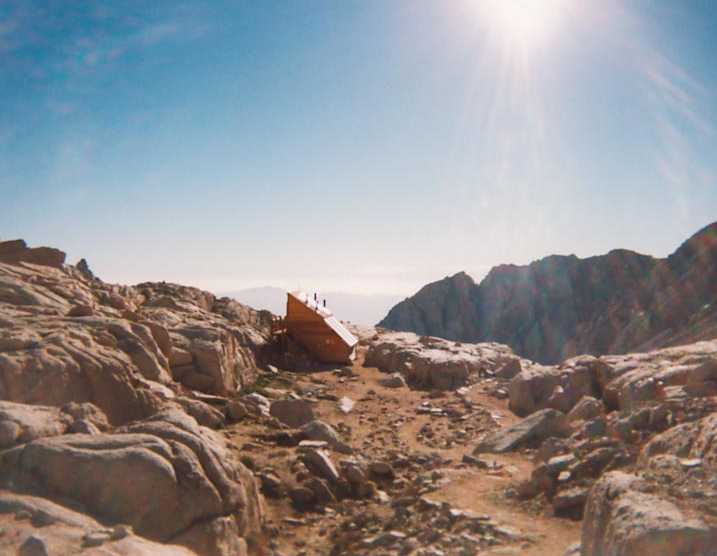
Me, Rick, John and Doug spent the night camping at the portal. And we started hiking at 4:00 am in the morning. It was cold, but not unbearable. The early pictures that I took were a little dark, so here is a nice bright photo. This is the view looking East around 12,000 ft elevation, aka Trail Camp. This is the solar toilet building. The picture looks fake. To me it looks like a tiny model of a building. Might be the Sun or just the resolution of the picture, 150 dpi. Check it out. |
|
Mr. Squirrel collecting tolls, He insisted on payment before we could pass. He only looks 8 feet tall. This is looking west up the trail. Maybe you can see the switch backs, some of the one hundred. We stopped here to filter water. John and Doug were left behind on the trail going at a slower pace. |
|
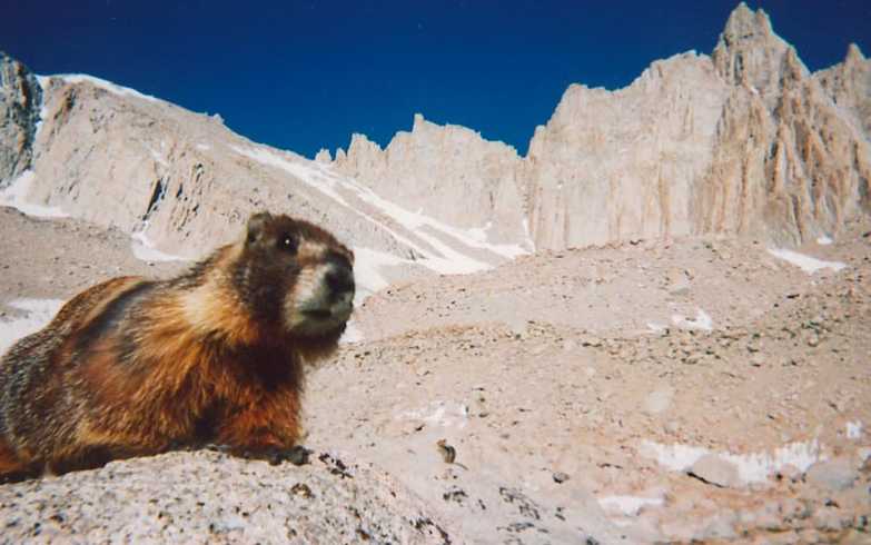
Marmot. Bold, mangy, hungry and too close. |
|
The only snow field that we crossed. The snow was very deeply cupped and no real path was laid down. Just pick your own way across. The way was intersected by glissade chutes that others had laid on their way down. Crossing these made me a little nervous. Not bad, no crampons or ice ax required. Maybe we could use one ourselves later? This is the top of the switch backs, above Trail Camp and just below Trail Crest. On the way down we bypassed this route. |
|
I lost Rick on the snow field. So I soloed Mt Muir alone. What a thrill! No trail, no signs, just kept on climbing up to 14,015 ft. Turned out that I did not take a direct route and reached a false summit to the south. On top is was a small area, you could fit only a couple of people at a time. The summit looks like a point from down below. At the summit I yelled 'Rick!'. Someone yelled back something, they were on the switch backs. Saw a small aluminum tube wedged in the rocks, pulled out the book and pen, did the summit sign in. What a view! |
|
This picture is Whitney from Muir. I could easily make out the summit building at the time. But the photo barely shows it. Look for it. |
|
That's Rick. He was up here waiting for me at the highest point
in the lower forty eight, 14,495 ft. That mountain is Russell to
the north of Whitney. That summit, at 14,086 ft is a sharp ridge
between two points. On either side of the ridge is a long way down...
Also, we saw White mountain, 3rd highest in California. Again it was real clear but the photo looses a lot. |
|
Lounging?! We deserve it! Enjoying the view to the South. That is another fourteeneer, Mount Langley, 14,027 ft. |
|
|
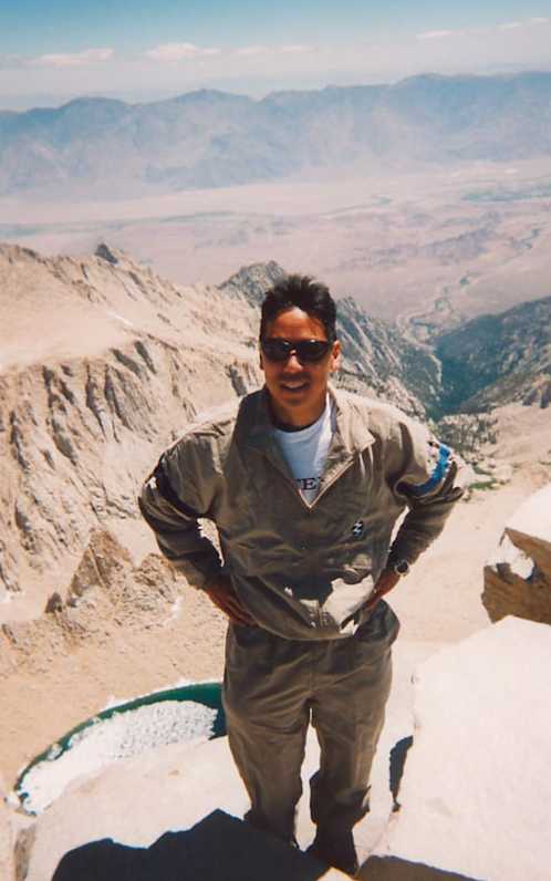
That's Me. That is the view from Whitney summit looking East. You can see Iceberg Lake, the top of Thor Peak, Whitney Portal, the Owens Valley and the White Mountains beyond. This is my third summit, second day trip, and I feel great. It's around 11:30 am. |
|
A shot taken by a kind hiker. She was one of a group of four young women who started just after us and attained the summit just after us. Wow. The summit building is directly behind us. The peaks behind us are in the Sequoia and Kings Canyon NP. Summit conditions were ideal, not windy. Visibility was great. Now all we have to do is get Rick up to Muir and get down the 11 miles of trail back to the car. We see Doug on his way up. We see John on his way down. We got to the car at 4:15 pm. It's Sunday and we need drive over 250 miles so we can work on Monday! |